Dawn Zoldi/P3 Tech Consulting
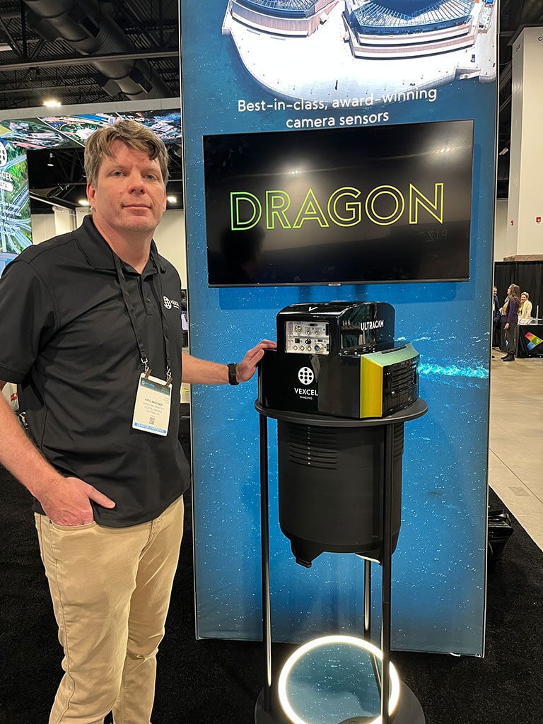
Vexcel’s Chief of Marketing showcases the UltraCam Dragon, a hybrid aerial mapping system, which combines advanced oblique imaging with LiDAR technology, at the company’s Geo Week booth.
At the highly anticipated annual Geo Week 2025 conference in Denver, Colorado, known for bringing together professionals from various sectors including surveying, mapping and remote sensing, a number of industry leaders showcased their company’s latest advancements in geospatial technology. “All the things” announced and showcased at Geo Week are simply too expansive to cover in this quick hit review – so instead we have chosen to highlight five significant improvements and updates from a few of the key players in the field. To learn more and listen to first impressions from a variety of geo industry leaders on the show floor, be sure to watch our Full Crew Geo Week 2025 event stream, sponsored by gNext ICYMI!
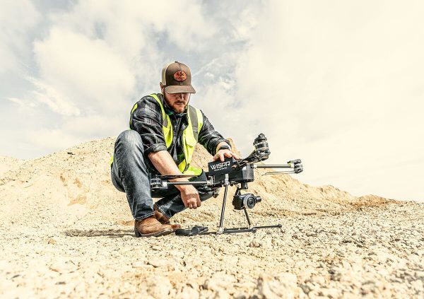
WISPR: Cloud-Based Geospatial Data Management Solution
WISPR Systems, a leader in drone-based geospatial data collection and processing, announced the launch of its new cloud-based data management solution. This platform aims to streamline the workflow for geospatial professionals, from data acquisition to analysis and sharing.
The WISPR Cloud solution offers several key features:
- Seamless Integration: The platform integrates directly with WISPR’s drone systems, allowing for automatic data upload and processing immediately after flight completion.
- Advanced Processing Capabilities: Leveraging cloud computing power, the system can handle large datasets, performing tasks such as point cloud classification, orthomosaic generation and 3D model creation more efficiently than traditional desktop solutions.
- Collaborative Environment: Users can easily share projects with team members or clients for real-time collaboration and feedback on geospatial data.
- AI-Powered Analytics: The platform incorporates machine learning algorithms to assist in feature extraction, change detection, and anomaly identification within datasets.
- Scalable Storage: With cloud-based storage, users can access their data from anywhere and scale their storage needs as projects grow.
- Compliance and Security: WISPR designed its cloud with industry-standard security protocols to help users maintain compliance with data handling regulations.
“Our new cloud solution represents a significant step forward in geospatial data management,” explained John McArthur, WISPR’s Vice President of Sales & Marketing. “By moving processing and storage to the cloud, we’re enabling our clients to work more efficiently and collaboratively, ultimately leading to better decision-making and project outcomes.” The WISPR Cloud platform will be available in March for existing WISPR drone system users. The company has plans to expand compatibility to other data sources in the near future.
Dawn Zoldi/P3 Tech Consulting
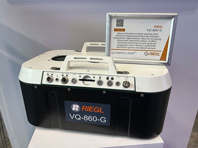
Riegl showcased multiple new latest developments in its airborne LiDAR line. Here pictured, the VQ-860-G for bathymetric missions.
Vexcel: Enhanced Reality Mapping Capabilities
Vexcel, a pioneer in aerial imaging and mapping, introduced noteworthy updates to their reality mapping platform. The company has made significant strides in bridging the gap between reality capture and GIS ecosystems by offering tools that allow users to process various types of imagery and seamlessly integrate them into their workflows. Its UltraCam Dragon, a hybrid aerial mapping system, combines advanced oblique imaging with LiDAR technology the following capabilities:
- High-Resolution Imaging: The Dragon incorporates two high-resolution nadir sensors (RGB Bayer pattern and NIR), four oblique RGB sensors and the Sony IMX-411 (CMOS) with 3.76 μm physical pixel size.
- Powerful LiDAR: Equipped with a 2.4 MHz RIEGL OEM LiDAR scanner capable of collecting up to 2 million measurements per second.
- Advanced Scanning Geometry: The LiDAR’s multi-axis scanning geometry, including a true nadir scan line, ensures maximum coverage of vertical features.
- Proprietary Image Processing: Utilizes Vexcel’s Adaptive Motion Compensation (AMC) and True Pixel Processing (TPP) for sharp, accurate imagery.
- Digital Twin Creation: Enables the creation of precise digital twins with comprehensive data capture13.
- Plug & Play Data Processing: Compatible with UltraMap Essentials and RIEGL’s RiProcess software.
One of the standout features is the ability to produce a full range of photogrammetry products, including digital surface models (DSM), 3D mesh models, and image mosaics. Vexcel’s platform now supports compatibility with LiDAR data, enhancing its versatility for users across different industries.The UltraCam Dragon represents Vexcel’s entry into the integrated line of their product lineup for enhanced accuracy and coverage for various mapping applications, including high-resolution mapping of complex urban environments. The WISPR Cloud platform is available in March for existing WISPR drone system users. The company has plans to expand compatibility to other data sources in the near future.
GeoCue: New Drone LiDAR Offerings
GeoCue revealed two new drone LiDAR products: the TrueView 1 Lite and TrueView 1. The company designed these additions to their product line to cater to the growing market of drone LiDAR users and offer more accessible options for those looking to enter the field. The TrueView 1 Lite, priced at $18,900, comes with a year of data processing included. It boasts a compact design weighing just 1.4kg and features a 5-megapixel camera for point cloud colorization. GeoCue has emphasized the standardization of this product, to facilitate quick manufacturing and delivery. For users seeking more flexibility, the TrueView 1 offers customizable options, including a choice of 26, 45, or 61-megapixel cameras. It also introduces the option for AP RTX AI muse processing. This eliminates the need for a local base station during flights. Both systems collect data at 640,000 pulses per second to provide high-density point clouds for various applications. According to a company spokesperson, GeoCue has also introduced flexible financing options to make these systems more accessible to a broader range of users.
Dawn Zoldi/P3 Tech Consulting
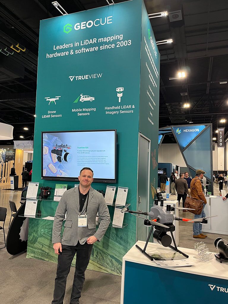
GeoCue’s booth at Geo Week 2025. The company revealed two new drone LiDAR products: the TrueView 1 Lite and TrueView 1.
Trimble: Next-Generation GNSS Solutions
Trimble introduced its next-generation GNSS solution, the APX, designed to provide high-accuracy positioning for various applications, including UAV mapping. The APX brings several key features to the table:
- CenterPoint RTX Complete: This service offers centimeter-level positioning in real-time and post-processing without the need for a base station. It provides fast convergence times in North America and Europe, with global availability for post-processing.
- Advanced IMU Technology: The APX incorporates Trimble’s Maxwell technology, offering high-sensitivity and performance in a compact 55g package.
- Flexible Models: Trimble introduced multiple APX models, including the APX 15, APX Extended, and higher-end models like APX Extended D3 and APX 50, catering to different performance requirements and applications.
- Improved Post-Processing: The new APX system allows for UAV post-processing without additional licenses, enabling users to install multiple instances of the software on different desktops.
- Enhanced Performance: Trimble has updated its specifications, particularly for the APX Extended, offering improved leveling accuracy and post-processed heading accuracy of 0.3 degrees.
The APX series stands ready to meet the growing demand for accurate geospatial data across industries. Improved post-processing capabilities and enhanced performance specifications further solidify Trimble’s leadership in cutting-edge solutions for precise positioning needs.
Riegl: Advancements in UAV LiDAR Systems

Dawn Zoldi/P3 Tech Consulting
A shot from the show of Trimble’s next-generation GNSS solution for UAVs, the APX.
Riegl showcased its latest developments in the UAV LiDAR space, introducing the new VUX-100 system. This update to their popular VUX line offers several improvements:
- Increased Field of View: The VUX-100 features a 160-degree field of view with a fully rotating scan pattern, optimizing data capture for typical UAV flight patterns.
- Higher Pulse Repetition Rate: The system now operates at 1.5 MHz, allowing for denser point clouds and more detailed data capture.
- Compact Design: Despite the performance improvements, the VUX-100 maintains a similar form factor to its predecessor, the VUX-120, ensuring compatibility with existing mounting solutions.
- NDAA Compliance: Riegl emphasized that their entire UAV LiDAR portfolio, including the new VUX-100, is compliant with the National Defense Authorization Act (NDAA), making it suitable for government and defense-related projects.
Riegl also introduced the RiLOCK system, their first venture into developing an INS/GNSS solution. This integrated system is designed to work seamlessly with Riegl’s mini VUX and VUX series for a more economical and lightweight solution for precise positioning and orientation. This short sampling of product updates and improvements showcased at Geo Week 2025 demonstrate the rapid pace of innovation in the geospatial technology sector. Learn more about Geo Week by subscribing to Geo News, our Autonomy Global Media Partner!
By: Dawn Zoldi


