>
USA Flag

Proudly Made In America

MENUCLOSE
Close
Contact Us

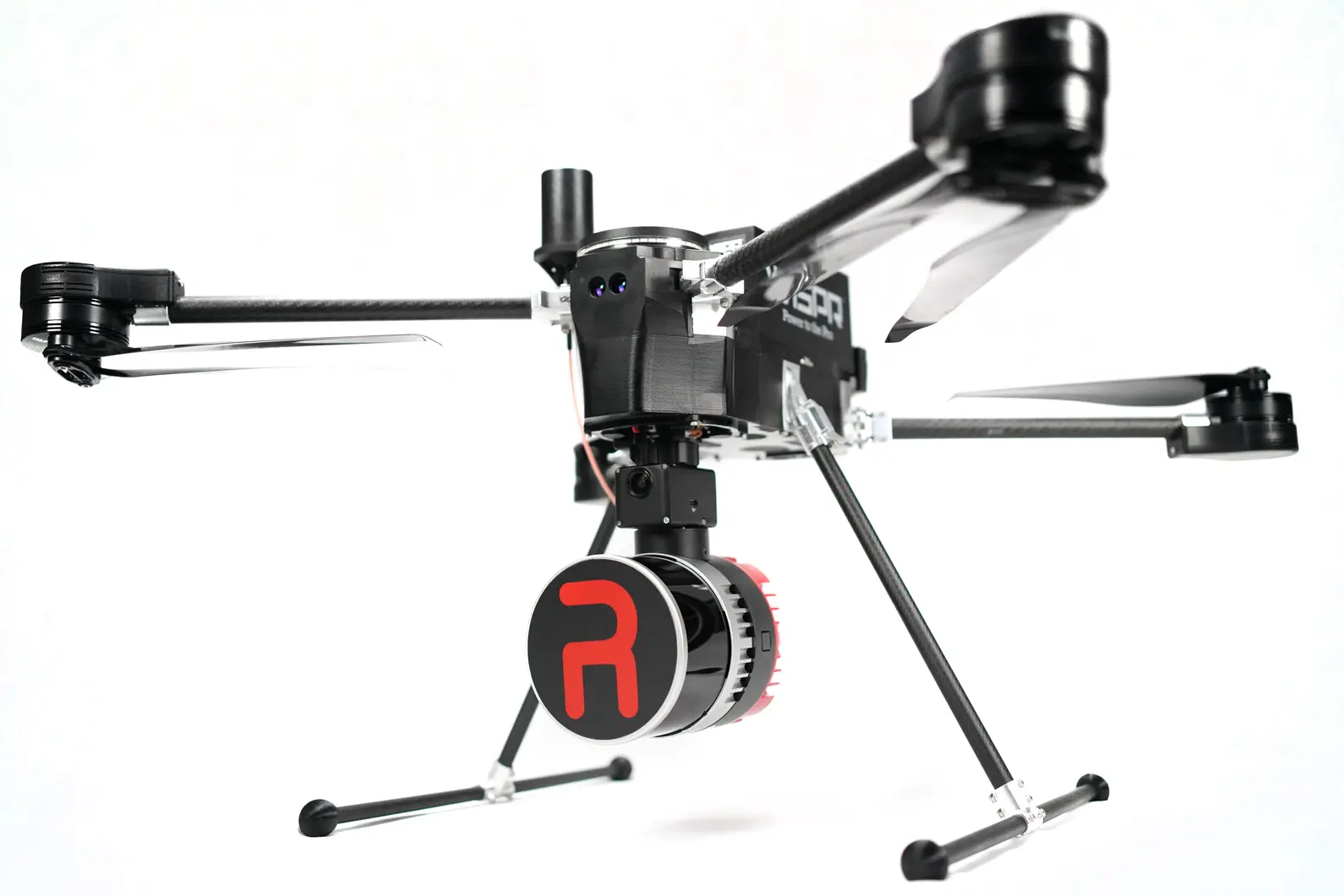
RESEPI XT32 by Inertial Labs

The Remote Sensing Payload Instrument

Compact and light-weight, the RESEPI XT-32 LiDAR scanner is an all-around very attractive system, offering the benefits of best-in-class data accuracy, good detection range, high point density, and versatility.

Sensor Type: LiDAR

Applications: Surveying/Mapping, Inspection, Infrastructure, Construction, Agriculture

Survey Grade Accuracy

Surveying has never been this easy

Learn More

Cover up to 150 acres on a single battery at 10m/s at 300ft AGL with this incredible sensor. You can expect accuracy ±3cm while also collecting RGB photos for point cloud colorization. Heavily vegetated area? With 32 lasers spinning 360 degrees, finding points beneath the canopy is no problem!

Tactical Grade IMU

A LiDAR unit is only as good as the IMU, and this is a great one

Learn More

The Inertial Labs Inertial Measurement Unit (IMU-P) is an Advanced MEMS sensors based, compact, self-contained strapdown, industrial and tactical grade Inertial Measurement Systems and Digital Tilt Sensor, that measures linear accelerations, angular rates, Pitch & Roll with three-axis highgrade MEMS accelerometers and three-axis tactical grade MEMS gyroscopes. Angular rates and accelerations are determined with high accuracy for both motionless and dynamic applications. The Inertial Labs IMU-P is breakthrough, fully integrated inertial solutions that combine the latest MEMS sensors technology.

Versatility

Who knew LiDAR could all this?

Learn More

Topographical surveying is no longer limited to line of sight. Mapping, GIS, modeling, volumetrics, digital twins, inspection, asset management, hydrology, mining, archeology… The list goes on and on.

This camera does more than just take pictures.

Tighten your model with the 24MP camera

Learn More

During the colorization of the point cloud, the images metadata becomes geotagged. These images can be made into a 3D model or point cloud of their own. Since they are both geotagged, they can be combined or supplement each other to achieve the best results.

Take A Closer Look

Specifications

LiDAR
RESEPI XT32
System Vertical Accuracy
±3cm
Weight
1.7 kg/3.75 lbs
Laser Range Capabilities
80m @ 10% (c9-24) 50m @ 10% (c1-8, 25-32) 0.05 to 120m
Range Accuracy
±1cm
FOV (Horizontal)
360°
FOV (Vertical)
31°
Number of Laser
32
Number of Returns
2
Pulse Rate
640k/s (single return) 1280k/s (dual return)
IMU
Inertial Labs Tactical Grade IMU-P
GNSS
Single/Dual Antenna NovAtel OEM7720 or uBlox ZED-F9P
Constellations
GPS, GLONASS, BEIDOU, GALILEO
Camera
24MP RGB Mapping Amera

Contact Us

Name(Required)
Email(Required)
Please let us know what's on your mind. Have a question for us? Ask away.
This field is for validation purposes and should be left unchanged.

We’re With You All the Way

With world-class training and support, owning one of our WISPR Systems American-made drones means years of productive and well-supported flying.