
Made In America
Made In America
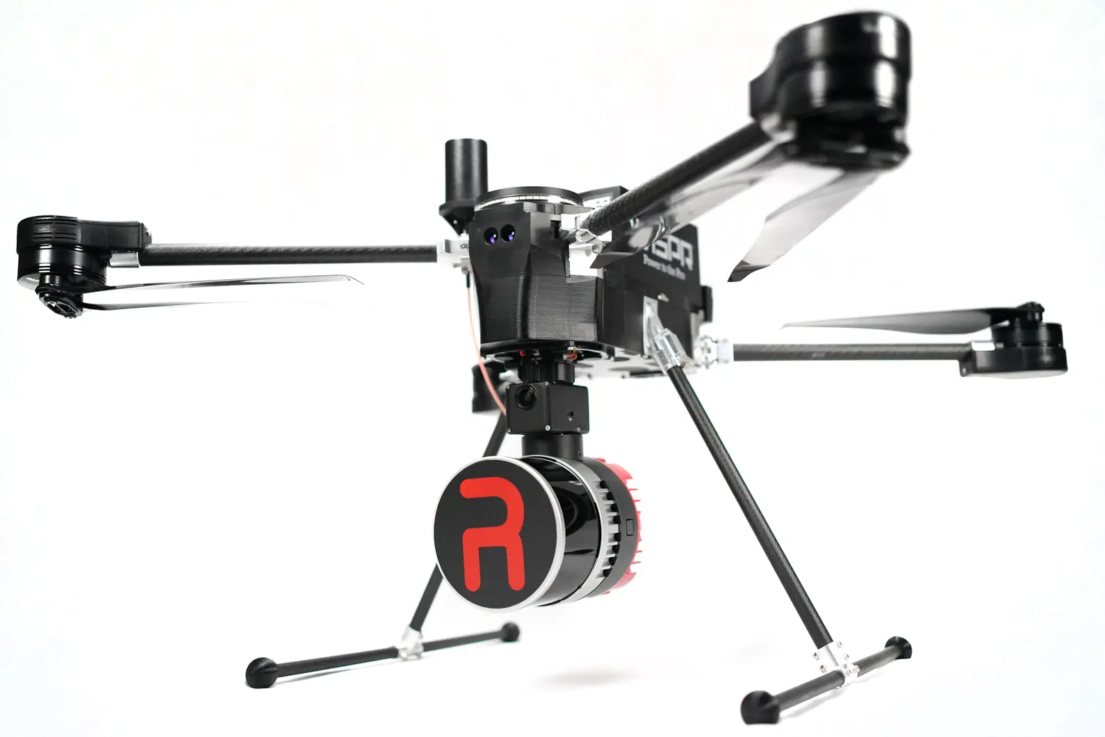
With a custom FPV quick attach, this payload seamlessly integrates with WISPR Systems’ SkyScout drone making it ideal for aerial mapping missions at low to mid-range altitudes. Its embedded 5MP colorization camera and ultra-lightweight design maximize endurance for extended missions.
Applications: Surveying/Mapping, Construction, Agriculture, Forestry, Mining
Designed for maximum flight efficiency, the RESEPI Ultra LITE is the lightest LiDAR + camera payload in its class. Its compact design extends flight time, making it the perfect solution for the WISPR Skyscout performing long-duration mapping missions.
Equipped with the Hesai XT-32 LiDAR, this system delivers 2-3 cm accuracy and high point density for precise 3D mapping. Ideal for utilities, construction, agriculture, and more, it ensures detailed and reliable data collection.
With a custom FPV quick attach, the RESEPI Ultra LITE is built for plug-and-play compatibility with the WISPR Skyscout. Quick mounting and dismounting allow for efficient deployment, keeping your operations running smoothly.
More than just an aerial payload—this system supports aerial scanning, handheld SLAM, and vehicle-mounted mobile mapping, making it a versatile tool for a wide range of 3D mapping applications.
With world-class training and support, owning one of our WISPR Systems American-made drones means years of productive and well-supported flying.
